
Asset Type
ML Model
Vessel Collision Risk Assessment and Forecasting (VCRA/F)
Python implementation of the VCRA/F model from the paper "Collision Risk Assessment and Forecasting on Maritime Data"
The Maritime sector is defined as consisting of the individual shipping, ports, marine and maritime business services industries, each of which comprise a diverse array of activities.
Python implementation of the VCRA/F model from the paper "Collision Risk Assessment and Forecasting on Maritime Data"
NN-SPM estimates ship fuel consumption taking into consideration weather and operational conditions.

Enhancing Efficiency and Sustainability with Artificial Intelligence
Maritime transport plays a vital role in our global economy, but navigating the vast ocean can be challenging. The AI4Copernicus ODFuse4Ship project, led by our Ocean-tech start-up AMPHITRITE, is set to change that by harnessing the power of satellite dat...
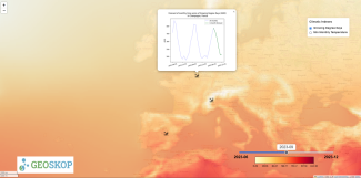
Introducing ESFA (Empirical Season Forecast for Agriculture) – your reliable companion in long-term agricultural planning. Our validated AI algorithms, which outperform other state-of-the-art climate prediction models, are at the core of ESFA's capabiliti...
Discover one of the breakthrough achievements of the ESFA project, a pioneer project in the field of Artificial Intelligence applied to Climate Prediction. Leveraging Geoskop’s revolutionary AI algorithms, housed in a Docker image, we provide unprecedente...
Apply and get access to Services, Tools, Training & Support for AI-based image analysis in aquatic sciences! iMagine provides: a. an online platform for the development and delivery of Artificial Intelligence (AI) based applications to analyse images in ...