
@ EU Copernicus - https://www.copernicus.eu
Earth observation plays a crucial role in supporting policy-making processes and developing some economic areas. A vast amount of earth observation data is collected that can feed AI models and methods and thus help to acquire new knowledge and develop innovative products. This section gives references on on-going projects and presents results in the area of AI in earth observation.


In a world where the preservation and sustainable management of our natural environment have never been more critical, Omikron Environmental Consultants SA stands as a beacon of innovation and expertise. This private consulting company is dedicated to saf...
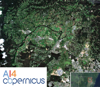
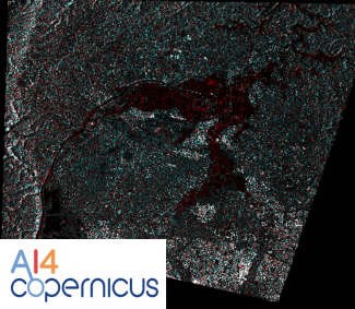
Pixel-level classification model, using the pixel-level classification bootstrapping service of AI4Copernicus project
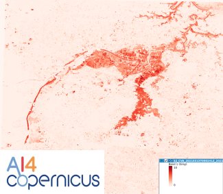
Pixel-level classification model, using the pixel-level classification bootstrapping service of AI4Copernicus project
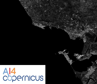
Pixel-level classification model, using the pixel-level classification bootstrapping service of AI4Copernicus project
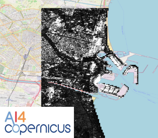
Pixel-level classification model, using the pixel-level classification bootstrapping service of AI4Copernicus project
The Security Bootstrapping services and resources have been developed in order to support the AI4Copernicus project’s open calls by reduce the time and resources of the bidders in the data preparation and allowing them to focus on the development of innov...
The Security Bootstrapping services and resources have been developed in order to support the AI4Copernicus project’s open calls by reducing the time and resources of the bidders in the data preparation and allowing them to focus on the development of inn...
The Security Bootstrapping services and resources have been developed in order to support the AI4Copernicus project’s open calls by reducing the time and resources of the bidders in the data preparation and allowing them to focus on the development of inn...
The Security Bootstrapping services and resources have been developed in order to support the AI4Copernicus project’s open calls by reducing the time and resources of the bidders in the data preparation and allowing them to focus on the development of inn...
The Security Bootstrapping services and resources have been developed in order to support the AI4Copernicus project’s open calls by reducing the time and resources of the bidders in the data preparation and allowing them to focus on the development of inn...
The model was designed for tree-crops semantic-segmentation and created using the AI4Copernicus service: “Deep network for pixel-level classification of S2 patches"