
@ EU Copernicus - https://www.copernicus.eu
Earth observation plays a crucial role in supporting policy-making processes and developing some economic areas. A vast amount of earth observation data is collected that can feed AI models and methods and thus help to acquire new knowledge and develop innovative products. This section gives references on on-going projects and presents results in the area of AI in earth observation.
5 year dataset with information on when phenological states have been reached in 11 different plots in La Rioja - Spain.
The model developed called SLIDE for SateLlite Images prediction with Deep Learning is a combination of state-of-the-art AI techniques that is designed to forecast irradiance maps. It uses up to four satellite-derived irradiance maps in order to genera...
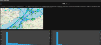
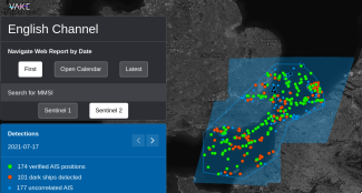
RF & OpenAIS Dashboard to allow users to quickly examine data without the need for custom software packages. This map compares AIS data with satellite-detected RF data.
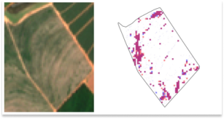
Automatic detection of in-field weeds using super-resolved Sentinel-2 at 1m per pixel imagery and delineated field boundaries.
The main sources of potential pollution during armed conflicts are usually heavy industrial sites and critical infrastructure that, when damaged, could result in major chemical releases. Therefore, a useful starting point is to identify vulnerable locatio...

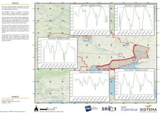
North and Central Mali entail the country’s highest prevalence of vulnerable communes siting at the intersection of chronic vulnerability, food insecurity, and armed conflict. Humanitarian and development programs are faced with diverse challenges in the ...
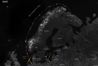
Monitor the tracks of specific ships - confirm AIS positions and fill in the gaps from periods of dark activity, through machine-learning ship detections.
Monitoring of specific areas - unlock Maritime Domain Awareness through AI vessel detections and AIS-fusion.
The Agriculture Bootstrapping services and resources have been developed in order to support the AI4Copernicus project’s open calls. The development of these bootstrapping services aimed to reduce the time and resources of the bidders in the data preparat...
TimeSen2Crop is a pixel based dataset made up of more than 1 million samples of Sentinel 2 Time Series associated to 16 crop types, during an agronomic year ranging from September 2017 to August 2018. The dataset contains atmospherically corrected samples...
This service is focused on probabilistic downscaling (super-resolution) of CAMS model output. Current AC and AQ models output forecasts at relatively low resolution (e.g., ca. 10 to 40 km for the CAMS EU and global domains). This service generates high-re...