Asset Type
ML Model
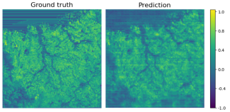
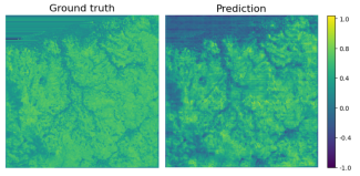
A model for tree-crops prediction in Sentinel-2 imagery
The model was designed for tree-crops semantic-segmentation and created using the AI4Copernicus service: “Deep network for pixel-level classification of S2 patches"