
@ EU Copernicus - https://www.copernicus.eu
Earth observation plays a crucial role in supporting policy-making processes and developing some economic areas. A vast amount of earth observation data is collected that can feed AI models and methods and thus help to acquire new knowledge and develop innovative products. This section gives references on on-going projects and presents results in the area of AI in earth observation.
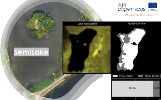
We introduce SemiLake, a semi-supervised representation learning-powered urban lakes and algae monitoring system.
AQQA was an AI4Copernicus micro-project, selected in the 5th round of open calls. It aimed to test a language-based interaction with air quality data by making use of linked geospatial data tools and the health bootstrapping service provided by the AI4Cop...
Land type: build-up, rural, forest, and water
The project SuperPower 2.0 developed thanks to I-NERGY open calls has developed an AI tool for automatic detection of broken insulators using a YOLO architecture. The end-goal of the developed system is to be able to provide end clients (power line own...
The projects SuperPower and SuperPower 2.0 developed thanks to I-NERGY open calls has developed super-resolution algorithms to increment the pixels in thermal and RGB images using Convolutional Neural Networks. The end-goal of the developed system is t...
The project SuperPower 2.0 developed thanks to I-NERGY second open call has developed super-resolution algorithms to increment the pixels in a thermal image using Convolutional Neural Networks. The datasets included consists of two subserts of original t...
The project SuperPower 2.0 developed thanks to I-NERGY second open call has developed super-resolution algorithms to increment the pixels in a thermal image using Convolutional Neural Networks. The datasets included consists of two subserts of original ...
This service is focused on Long Short-Term Memory Neural Networks for classification and prediction of NDVI values on Sentinel-2 image time series. This service provides trainable models for the crop type mapping task and the prediction, and a pre-trained...
The sercvice is focused on the production of monthly composites for agronomical time series of Sentinel-2 images. One of the challenges of crop type mapping at large scale is the definition of a regular temporal sampling grid to perform analysis in a stan...
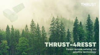
THRUST-4RESST is a multifunctional forest condition assessment tool that is based on AI-aided analytics of time-resolved satellite data
A toolkit for processing geospatial data, featuring an array of functions and workflows crucial for managing and analyzing information related to geospatial and terrain features. Developed by AMIGO s.r.l. for the ARIA project, part of the I-NERGY 2nd Ope...
A collection of Python methods intended as a practical tool for fetching and preprocessing data related to climate and weather conditions, useful in climate science studies. Developed by AMIGO s.r.l. for the ARIA project, part of the I-NERGY 2nd Open Cal...