
@ EU Copernicus - https://www.copernicus.eu
Earth observation plays a crucial role in supporting policy-making processes and developing some economic areas. A vast amount of earth observation data is collected that can feed AI models and methods and thus help to acquire new knowledge and develop innovative products. This section gives references on on-going projects and presents results in the area of AI in earth observation.
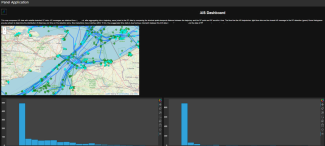
RF & OpenAIS Dashboard to allow users to quickly examine data without the need for custom software packages. This map compares AIS data with satellite-detected RF data.
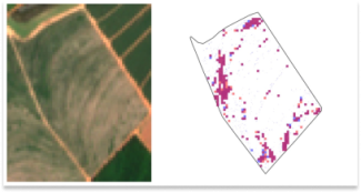
Automatic detection of in-field weeds using super-resolved Sentinel-2 at 1m per pixel imagery and delineated field boundaries.
The main sources of potential pollution during armed conflicts are usually heavy industrial sites and critical infrastructure that, when damaged, could result in major chemical releases. Therefore, a useful starting point is to identify vulnerable locatio...

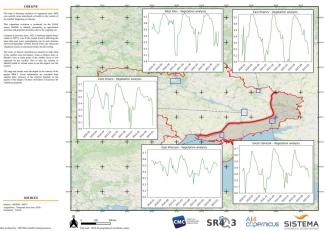
North and Central Mali entail the country’s highest prevalence of vulnerable communes siting at the intersection of chronic vulnerability, food insecurity, and armed conflict. Humanitarian and development programs are faced with diverse challenges in the ...


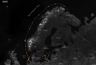
Monitor the tracks of specific ships - confirm AIS positions and fill in the gaps from periods of dark activity, through machine-learning ship detections.
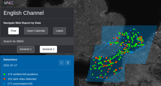
Monitoring of specific areas - unlock Maritime Domain Awareness through AI vessel detections and AIS-fusion.
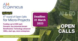
NEW! AI4Copernicus 5th round of Open Calls: Documentation Available!